

HIKING ITINERARIES
in val troncea
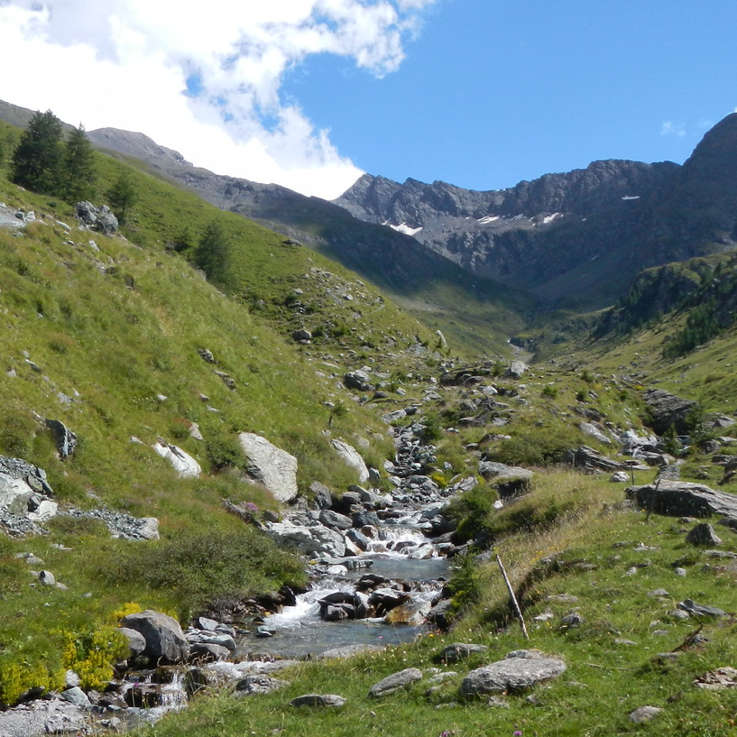
Discover the richness of the valley
HIKING ITINERARIES
The Mulino di Laval Hiking Refuge is located about 500 metres from
Bivio Seytes, where the Val Troncea Natural Park begins. Its strategic position allows the customer to reach the starting point of more than 10 hiking trails, differentiated by difficulty, in just a few minutes on foot. For more information, please visit the website of the
Parco Alpi Cozie authority, which is responsible for measuring and mapping the trails proposed here.

Trail cadastre code: ETOS334
Access by car: Car park in Val Troncea in Loc. Bivio Seytes (in summer usually for a fee), or from Troncea by shuttle service
Departure altitude: 1915 m. B.ta Troncea (if you plan to start from the car park, departure altitude 1670 mt.)
Arrival altitude: 2781 mt. Arcano Pass
Time required: 3h 10 min from Troncea
Difficulty: E
Length: 7.5 km
Points of interest: path that for the first part coincides with the one that goes up to the Colle del Beth up to Loc. Forni di san Martino, from the pass it is possible to go down to the Vallone di Massello in Balziglia or to go back to the Colle del Pis from the path of the Alpini (ETOS215)
Access by car: Parking in Val Troncea at Bivio Seytes (in summer, usually for a fee), or from the fork in the road before the ford on the Chisone Loc. Mey with shuttle service.
Departure altitude: 2028 m. crossroads on the road before the ford on the Chisone Loc. Mey
Arrival altitude: 2427 mt. Sources of the Chisone
Time required: 2h 30 min
Difficulty: E
Length: 4 Km
Points of interest: Sorgenti del Chisone
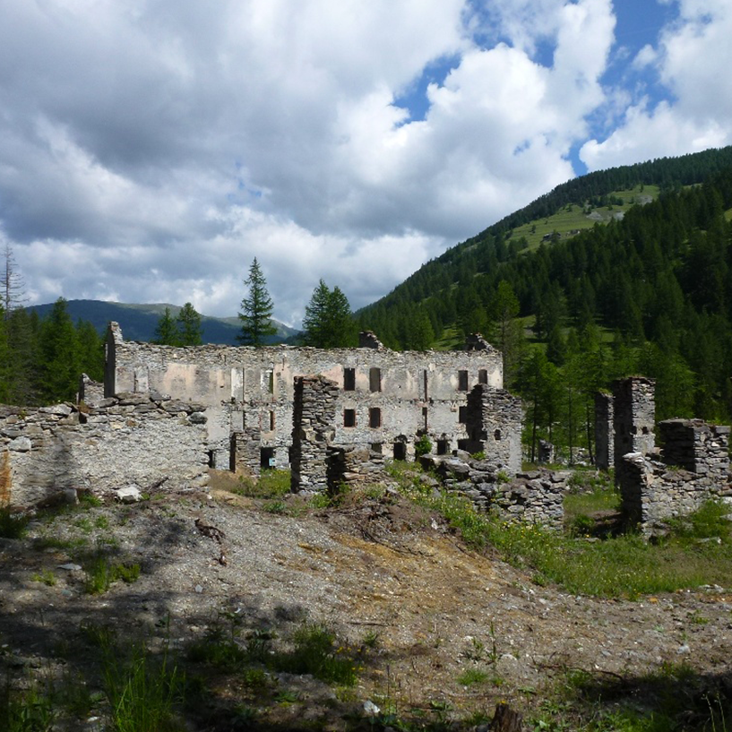
Self-guided route among the ruins of the La Tuccia Foundry archaeo-mineral site.
Access by car: Parking in Val Troncea in Loc Bivio Seytes (in summer, usually for a fee), or from the crossroads on the road in Loc Fonderia La Tuccia with a shuttle service.
Departure altitude: 1735 m. Loc. Fonderia La Tuccia.
Arrival altitude: 1735 m. Loc. Fonderia La Tuccia
Walking time: 30 min
Difficulty: T - accessible to motor-impaired persons.
Length: 1 km


